
35,000+ smart investors are already getting financial news, market signals, and macro shifts in the economy that could impact their money next with our FREE weekly newsletter. Get ahead of what the crowd finds out too late. Click Here to Subscribe for FREE.
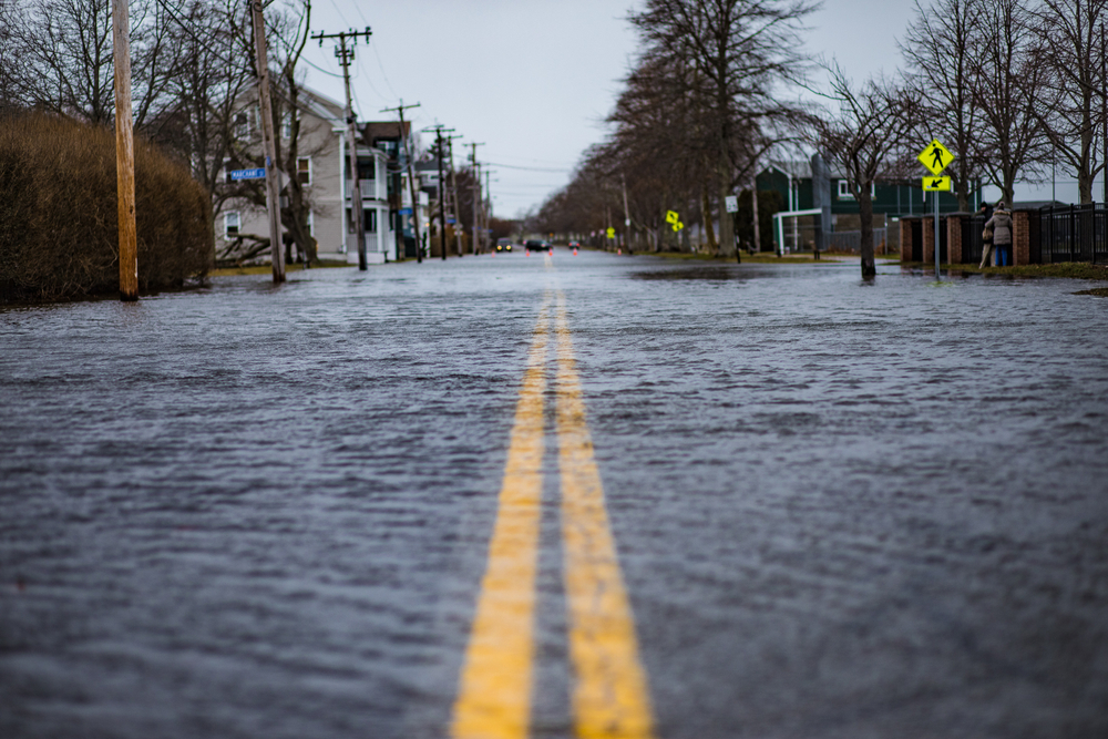
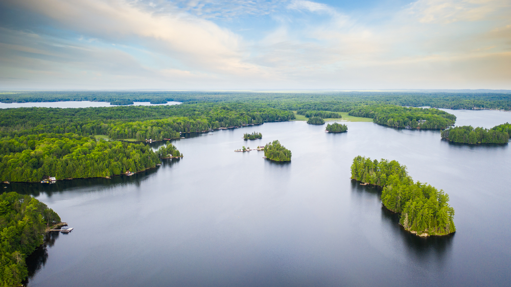
Flood maps shape where Canadians build, insure, and plan their lives. They also rely on historical patterns that no longer behave as expected. Across the country, weather systems are shifting faster than planning cycles can handle. Rain is falling harder, snow is melting earlier, and coastlines are changing shape. Rivers once predictable now behave like wild cards after extreme storms. Here are 14 climate threats that could redraw Canada’s flood maps overnight.
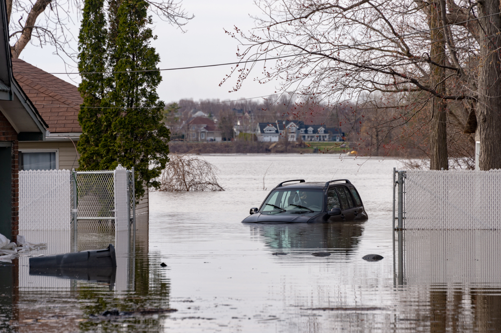
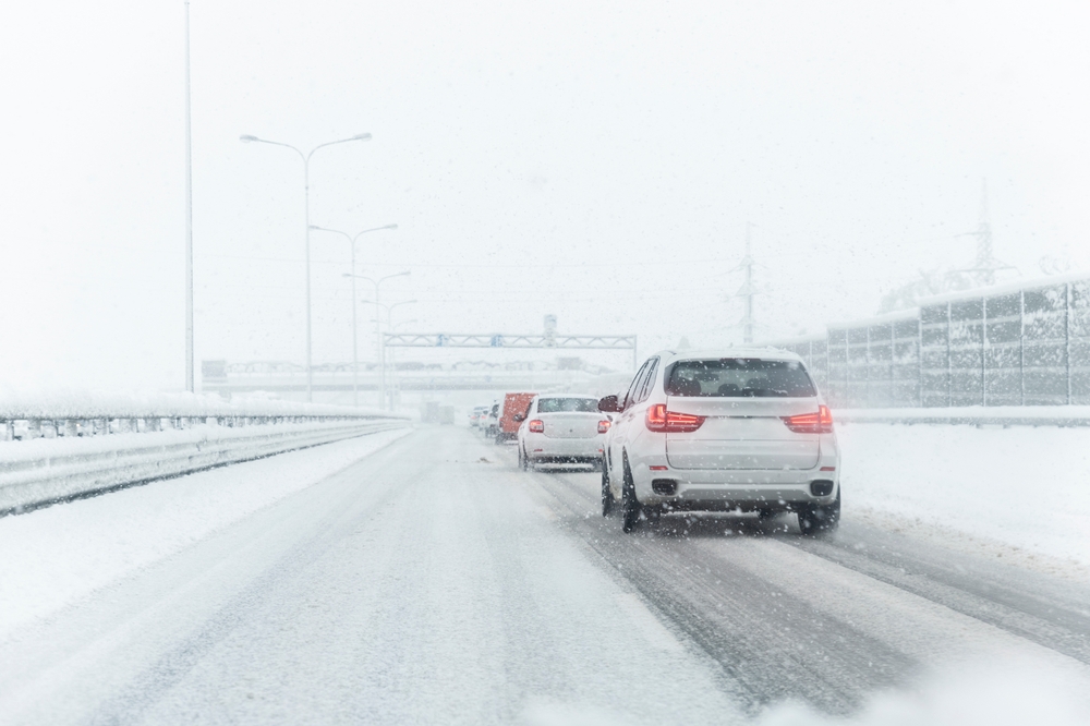
Atmospheric Rivers Reaching Farther Inland
14 Climate Threats That Could Redraw Canada’s Flood Maps Overnight
- Atmospheric Rivers Reaching Farther Inland
- Faster Snowmelt Triggered by Warm Spring Spikes
- Rising Sea Levels Along Canada’s Coasts
- Stronger Storm Surges From Intensifying Coastal Storms
- Urban Sprawl Reducing Natural Water Absorption
- Burned Forests Increasing Runoff After Wildfires
- Thawing Permafrost Altering Northern Drainage Patterns
- Heavier Short-Duration Rainfall Events
- Ice Jam Flooding Becoming More Erratic
- Loss of Wetlands That Once Absorbed Floodwater
- River Channel Changes After Extreme Floods
- Aging Dams and Levees Facing New Stress
- Shifting Lake Levels Affecting Shoreline Communities
- Compound Events That Stack Multiple Risks
- 22 Groceries to Grab Now—Before another Price Shock Hits Canada
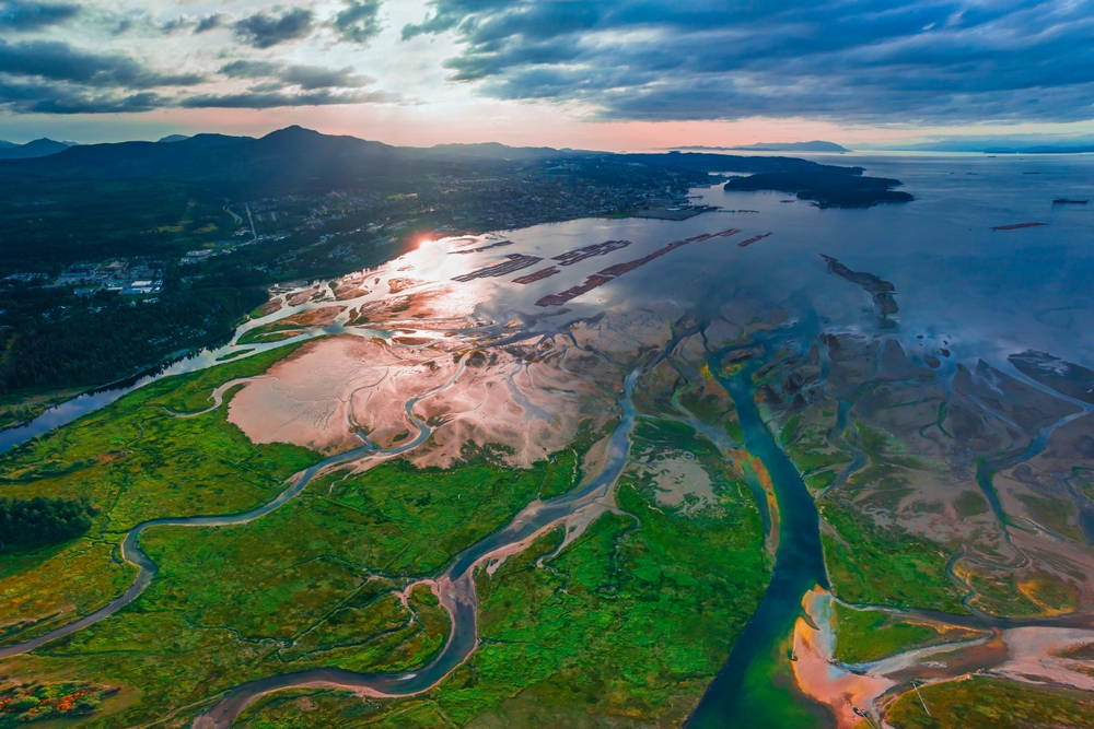
Atmospheric rivers are long bands of moisture that dump extreme rain over short periods. Canada has seen more of them reach inland areas. These storms overwhelm rivers that were never built for such volumes. Flood maps often rely on older rainfall averages. When those averages break, flood boundaries fail too. Mountain regions face sudden runoff that moves downhill fast. Low-lying towns downstream absorb the damage. The infrastructure struggles to drain water quickly enough. Roads wash out before warnings spread. Communities outside historic flood zones suddenly face water inside homes. One intense event can shift risk classifications permanently. Insurers and planners must adjust faster than models predict.
Faster Snowmelt Triggered by Warm Spring Spikes
Snowpack once melted slowly, feeding rivers over weeks. Sudden spring heat now releases that water in days. Rivers swell before communities prepare. Flood maps based on gradual melt underestimate peak flow. Prairie and mountain regions feel this shift sharply. Frozen ground prevents water from soaking in. Meltwater runs directly into creeks and rivers. Ice jams worsen the problem, pushing water sideways into towns. Even modest rain during melt periods multiplies risk. Areas previously considered safe are seeing rapid flooding. This compresses response time for emergency services. One warm spell can change flood assumptions for an entire watershed.
Rising Sea Levels Along Canada’s Coasts
Sea levels along Canada’s coasts are climbing steadily. Higher baseline water makes storm surges more destructive. Flood maps that ignore future sea levels miss real exposure. Coastal homes face flooding from smaller storms than before. Tides now push water into streets and drainage systems. Saltwater reaches farther inland during storms. Shorelines erode, removing natural buffers. Protective dunes and wetlands disappear faster. Once lost, flood risk expands quickly. Maps drawn even ten years ago already look outdated. A single severe coastal storm can redefine flood zones overnight for entire neighborhoods.
Stronger Storm Surges From Intensifying Coastal Storms
Coastal storms are carrying more energy and moisture. This increases storm surge height during landfall. Surge pushes seawater inland beyond previous limits. Flood maps often rely on historical surge records. Those records no longer reflect current extremes. Ports, roads, and homes face water intrusion faster. Drainage systems back up under pressure. Communities see flooding even without heavy rain. Combined wind and surge cause structural damage. After one major event, risk lines shift inland. Insurance premiums follow quickly. Coastal planning assumptions change after a single destructive surge.
Urban Sprawl Reducing Natural Water Absorption
Cities continue to spread outward across Canada. Pavement replaces soil, grass, and wetlands. Rainwater has fewer places to go. Runoff reaches rivers faster and in greater volume. Flood maps may ignore rapid land use changes. Suburbs once safe now sit in expanded runoff paths. Storm drains struggle during heavy rain. Water pools in streets and basements. Older neighborhoods face combined sewer backups. Urban flooding becomes common, not exceptional. One extreme rainfall event exposes weaknesses. Municipalities must redraw flood risk boundaries to reflect hardened surfaces and faster runoff.
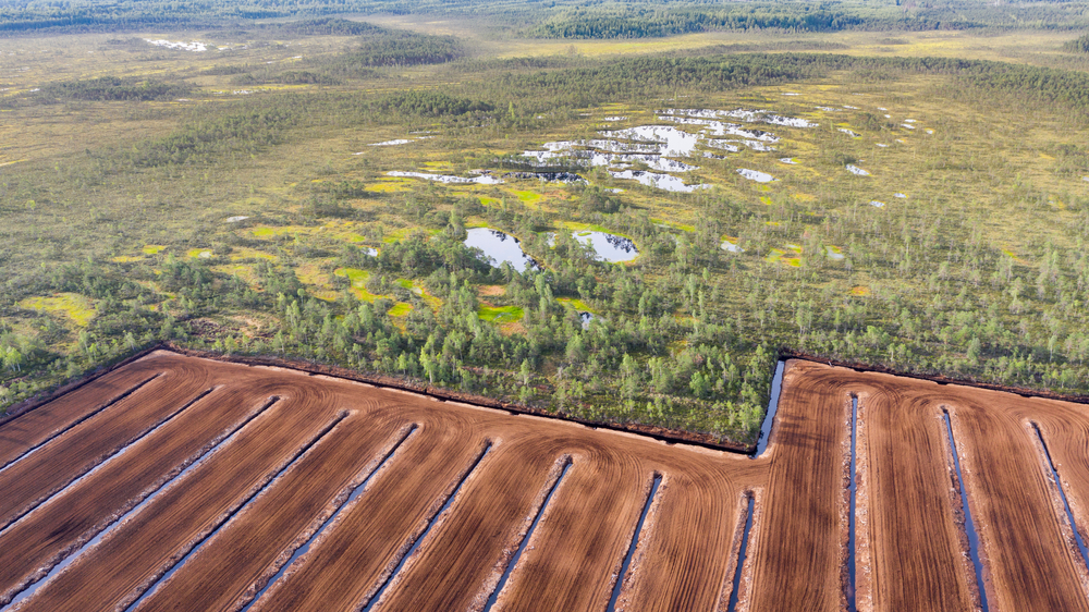
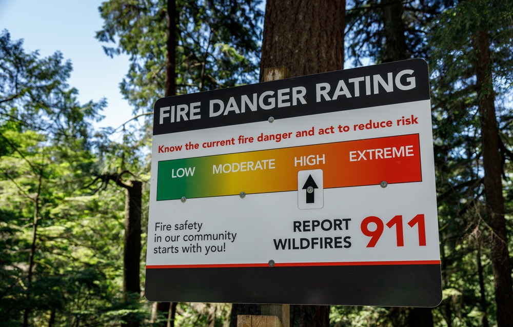
Burned Forests Increasing Runoff After Wildfires
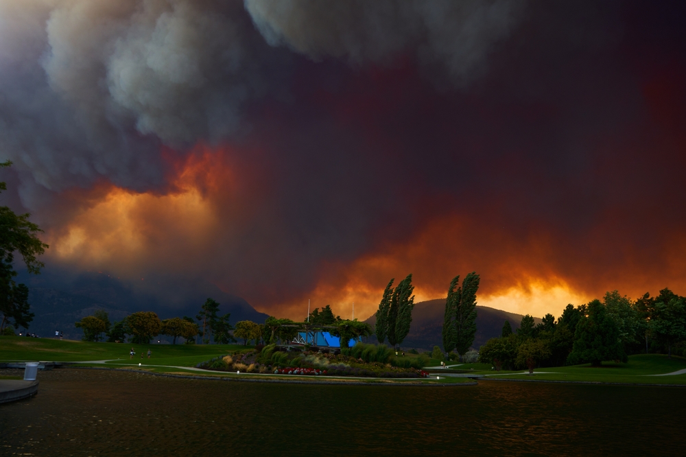
Wildfires leave behind scorched landscapes that repel water. Burned soil absorbs far less rainfall. When rain arrives, water rushes downhill quickly. Streams rise faster than expected. Flood maps rarely account for recent burn scars. Communities downstream face surprise flooding months after fires end. Ash and debris clog culverts and channels. This worsens overflow during storms. Even moderate rain can cause flash floods. Mountain valleys feel this risk intensely. A single wildfire season can reshape flood behavior. Maps must change to reflect altered watersheds and lost forest buffers.
Thawing Permafrost Altering Northern Drainage Patterns
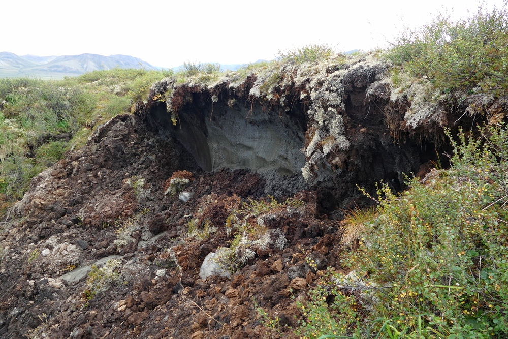
Permafrost once locked soil and water in place. As it thaws, the ground structure collapses. New drainage channels form unpredictably. Water pools in places once dry. Rivers shift course slowly, then suddenly. Flood maps struggle to keep pace with these changes. Northern communities face flooding without heavy rainfall. Infrastructure sinks and cracks, redirecting water. Ice-rich ground releases large volumes during thaw. This changes seasonal flow patterns. One warm summer can alter landscapes permanently. Flood risk assessments must be updated often to reflect unstable ground conditions.
Heavier Short-Duration Rainfall Events
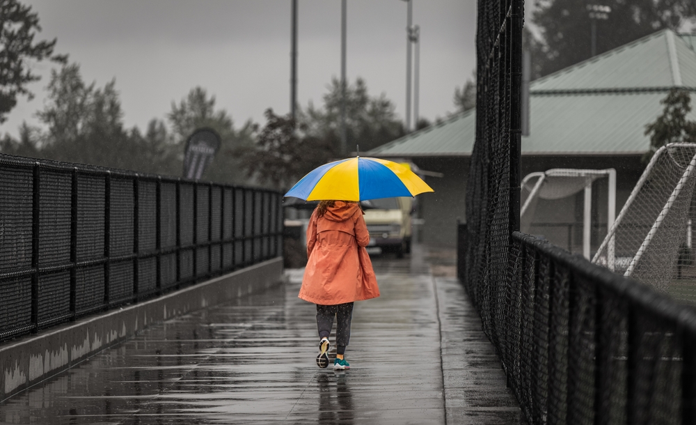
Rainfall is arriving in shorter, heavier bursts. Drainage systems designed for steady rain fail quickly. Flood maps based on daily totals miss peak intensity. Urban and rural areas both suffer flash flooding. Small creeks overflow in minutes. Roads turn into temporary rivers. Emergency alerts struggle to keep up. Even areas outside floodplains experience damage. This type of rain overwhelms soil absorption. Climate records show rising intensity trends. After one extreme downpour, local flood risk lines shift. Maps must reflect intensity, not just average rainfall.
Ice Jam Flooding Becoming More Erratic
Ice jams form when river ice breaks unevenly. Warmer winters increase freeze-thaw cycles. This creates unstable ice conditions. Jams block water flow suddenly. Water backs up and spills onto land. Flood maps often struggle to predict jam locations. Communities far from heavy rain are still flooded. Rapid temperature swings worsen this risk. Ice moves unpredictably during spring breakup. One jam can flood areas previously untouched. After damage occurs, flood zones expand. Changing winter patterns make ice jam flooding harder to forecast, but more frequent.
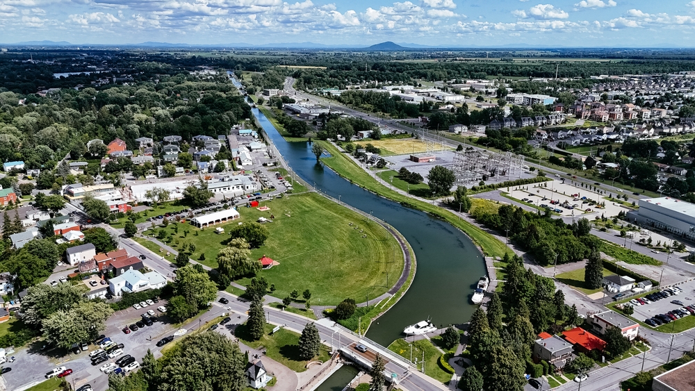
Loss of Wetlands That Once Absorbed Floodwater
Wetlands act like natural sponges during storms. Many have been drained or built over. Without them, water moves faster downstream. Flood maps sometimes assume wetlands still function. Their loss increases peak flood levels. Rivers crest higher with less warning. Wildlife habitat loss also removes natural buffers. Communities downstream feel the impact. Restoring wetlands takes time, but floods happen now. One major storm exposes missing protection. Risk boundaries expand where wetlands once slowed water. Planning models must adjust to account for their disappearance.
River Channel Changes After Extreme Floods
Extreme floods reshape river channels. Banks erode, and channels widen or shift. Water flows differently after such events. Flood maps based on old channels become inaccurate. New flow paths emerge during future storms. Sediment buildup redirects currents. Bridges and culverts face new stress points. Communities see flooding in unfamiliar areas. One major flood can permanently alter river behavior. Updating maps becomes urgent after channel shifts. Without updates, risk is underestimated. Changing river geometry forces planners to redraw flood zones quickly.
Aging Dams and Levees Facing New Stress
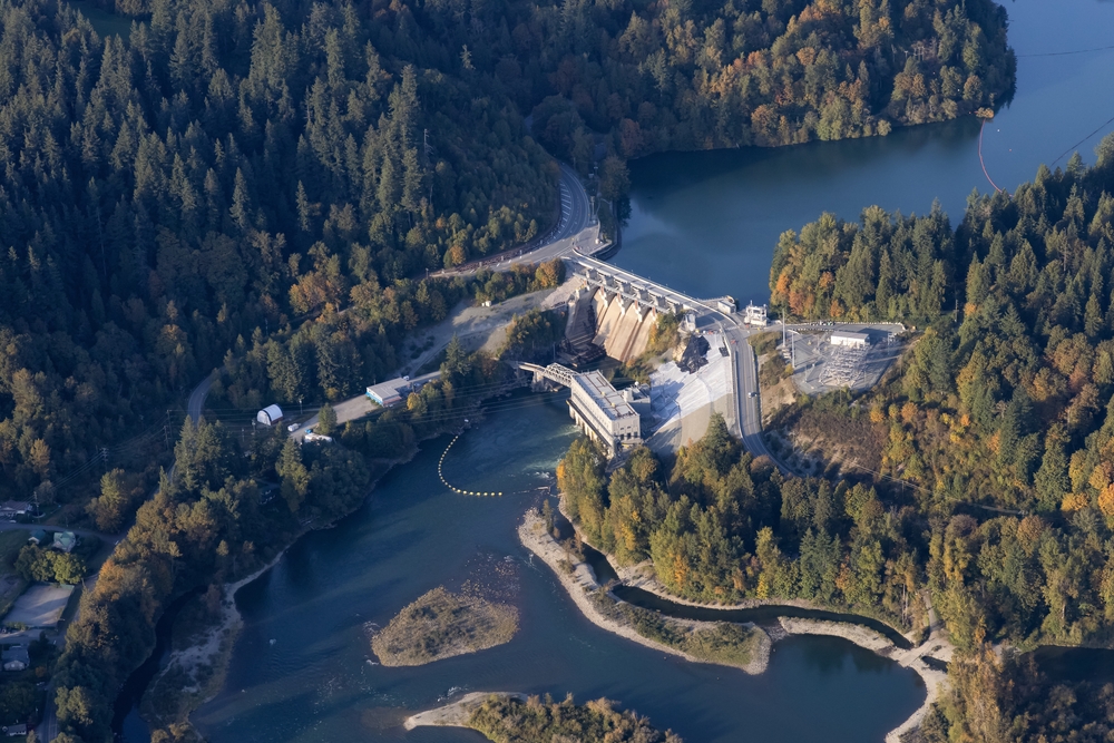
Many dams and levees were built decades ago. They were designed for smaller floods. Climate-driven extremes push them beyond limits. Structural failure risks increase during heavy flow. Flood maps often assume these defenses hold. When they fail or overtop, flooding spreads fast. Downstream areas face sudden inundation. Maintenance struggles keep pace with rising stress. One near miss changes risk perception instantly. Authorities must revise flood zones around aging infrastructure. Reliance on outdated protection creates false security.
Shifting Lake Levels Affecting Shoreline Communities
Large lakes in Canada experience changing water levels. Increased precipitation raises average levels. Strong winds push water onto the shores. Flood maps based on stable lake levels fall short. Shoreline erosion accelerates. Properties lose land protection. Storm-driven waves reach farther inland. Drainage systems backflow during high lake stages. Communities see flooding without river overflow. One season of high levels can redefine shoreline risk. Maps must include dynamic lake behavior. Static assumptions no longer match reality.
Compound Events That Stack Multiple Risks
Flooding often results from combined threats. Heavy rain during snowmelt raises rivers fast. Storm surge coinciding with high tides worsens coastal flooding. Wildfire scars amplify rainfall impacts. Flood maps rarely model these compound events. When risks stack, damage spreads wider. Communities outside mapped zones are caught off guard. Emergency planning becomes harder. One compound event can rewrite multiple assumptions. Climate patterns favor these overlaps more often. After such an event, flood zones expand sharply. Planning must account for overlapping hazards, not isolated ones.
22 Groceries to Grab Now—Before another Price Shock Hits Canada

Food prices in Canada have been steadily climbing, and another spike could make your grocery bill feel like a mortgage payment. According to Statistics Canada, food inflation remains about 3.7% higher than last year, with essentials like bread, dairy, and fresh produce leading the surge. Some items are expected to rise even further due to transportation costs, droughts, and import tariffs. Here are 22 groceries to grab now before another price shock hits Canada.
22 Groceries to Grab Now—Before another Price Shock Hits Canada
This Options Discord Chat is The Real Deal
While the internet is scoured with trading chat rooms, many of which even charge upwards of thousands of dollars to join, this smaller options trading discord chatroom is the real deal and actually providing valuable trade setups, education, and community without the noise and spam of the larger more expensive rooms. With a incredibly low-cost monthly fee, Options Trading Club (click here to see their reviews) requires an application to join ensuring that every member is dedicated and serious about taking their trading to the next level. If you are looking for a change in your trading strategies, then click here to apply for a membership.