
35,000+ smart investors are already getting financial news, market signals, and macro shifts in the economy that could impact their money next with our FREE weekly newsletter. Get ahead of what the crowd finds out too late. Click Here to Subscribe for FREE.
Winter may get the headlines, but summer and shoulder seasons send plenty of Canadians into the backcountry unprepared. Search and rescue teams respond to thousands of calls each year across the country. Many involve dehydration, wrong turns, weather shifts, and simple overconfidence. Some trails look short on paper yet hide steep scrambles, loose rock, and fast-changing conditions. Knowing which hikes cause repeated rescues can help you plan better and pack smarter. Here are 12 Canadian hikes that require rescues every year.
Grouse Grind, British Columbia
12 Canadian Hikes That Get People Rescued Every Year (And How to Be Smart)
- Grouse Grind, British Columbia
- Stawamus Chief, British Columbia
- Garibaldi Lake, British Columbia
- West Coast Trail, British Columbia
- Mount Temple, Alberta
- Plain of Six Glaciers, Alberta
- Skyline Trail, Alberta
- The Crack, Ontario
- Mount Albert, Quebec
- Fundy Footpath, New Brunswick
- Cape Split, Nova Scotia
- The Lions, British Columbia
- 22 Groceries to Grab Now—Before another Price Shock Hits Canada
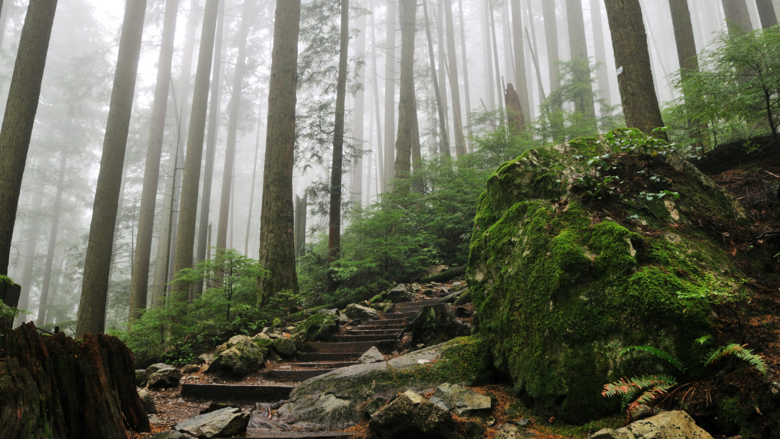
The Grouse Grind in North Vancouver draws thousands every week. It climbs almost 800 meters in under three kilometers. Many visitors treat it like a casual walk. It is not. Heat exhaustion, dehydration, and knee injuries are common. Bring water, proper shoes, and realistic expectations. Start early to avoid peak heat. If you feel dizzy, stop and rest. There is no shame in turning around. The mountain will still be there tomorrow. Your safety matters more than the summit selfie.
Stawamus Chief, British Columbia
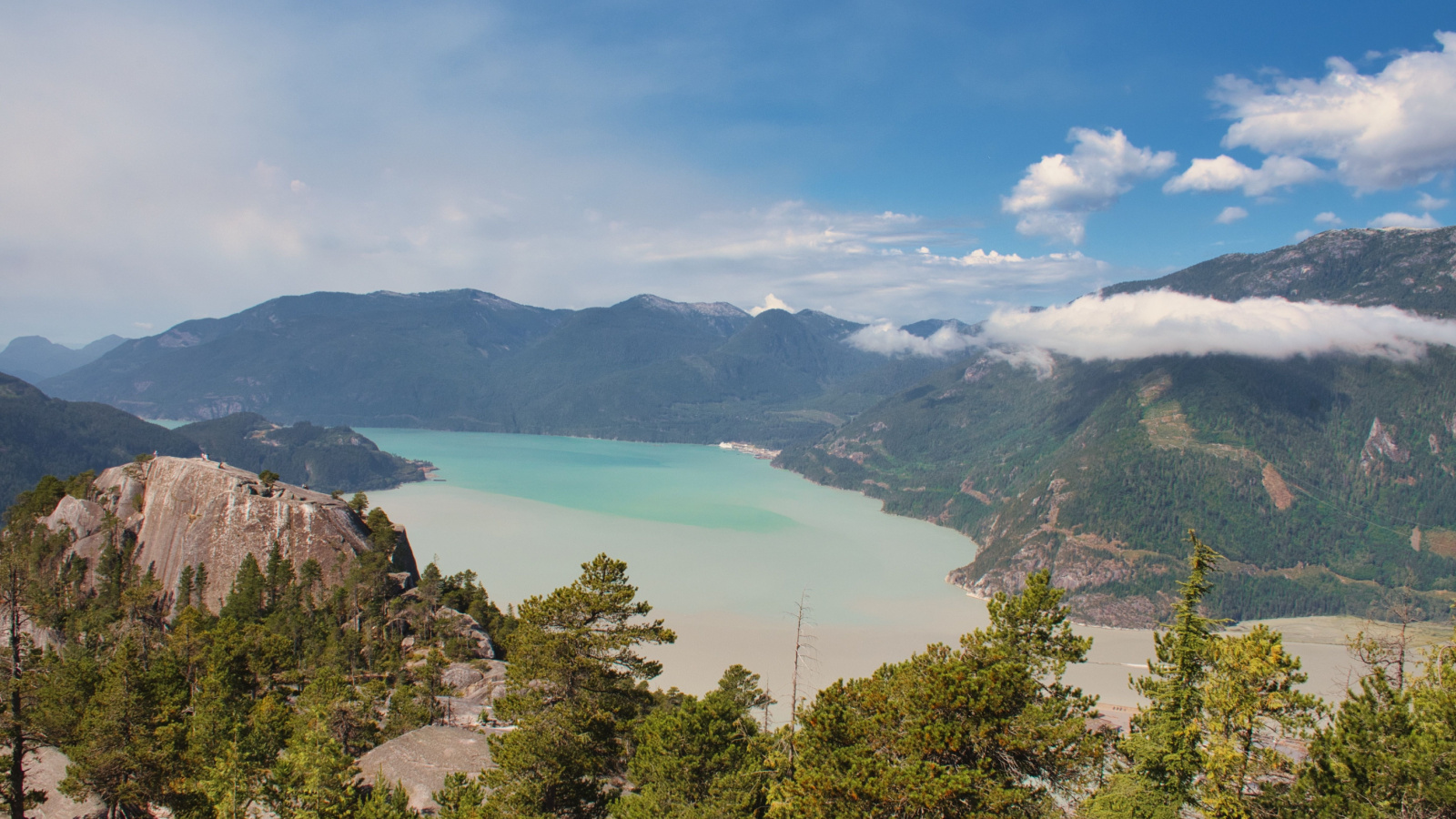
The Stawamus Chief in Squamish looks straightforward from the highway. Up close, it involves steep stair sections and exposed rock. Wet granite becomes slippery fast. Hikers often underestimate how long the descent takes. Fatigue causes missteps late in the day. Some wander onto climbing routes by mistake. Carry enough water and check the forecast carefully. Wear shoes with a solid grip. Avoid the edge near cliffs, especially in the wind. Plan extra time for the way down. Many rescues happen after dark. A headlamp weighs little and can prevent a long, cold wait for help.
Garibaldi Lake, British Columbia

Garibaldi Lake attracts hikers with its bright turquoise water. The trail seems gradual but stretches nearly 20 kilometers round trip. People start late and run out of daylight. The weather can change quickly here. Snow lingers well into summer. Unprepared hikers face hypothermia and exhaustion. Bring layers even on warm days. Pack food beyond a single snack bar. Check snow reports before heading out. Trekking poles help on steep switchbacks. Tell someone your plan and expected return time. A long trail demands pacing and patience. Rushing leads to mistakes that require outside assistance.
West Coast Trail, British Columbia

The West Coast Trail spans 75 kilometers of rugged coastline. It requires permits, preparation, and respect for tides. Each year, hikers need evacuation for injuries or poor planning. Slippery boardwalks and ladders test balance. Ocean swells can trap careless walkers. Study tide charts before setting out. Bring reliable rain gear and waterproof storage. Break in boots before arrival. Do not underestimate how heavy your pack will feel by day three. Build rest time into your schedule. The trail rewards steady progress. Overconfidence and tight timelines often end with a helicopter ride off the beach.
Mount Temple, Alberta
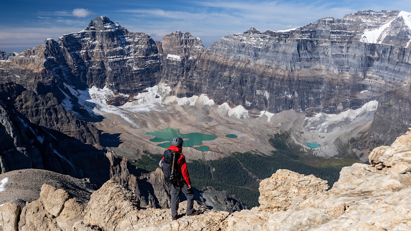
Mount Temple in Banff National Park attracts ambitious hikers. The summit route crosses loose scree and exposed ridges. Sudden storms sweep in without warning. Many underestimate the distance and elevation gain. Some start without helmets, despite rockfall risk. Others push upward despite dark clouds. Check conditions through Parks Canada updates. Begin at dawn to allow safe turnaround time. Carry extra layers and emergency supplies. Travel with experienced partners if possible. Know your limits before leaving the parking lot. Turning back below the peak is smarter than calling for rescue above it.
Plain of Six Glaciers, Alberta

The Plain of Six Glaciers trail near Lake Louise appears manageable. It draws families and first-time visitors. Yet the full hike covers over 14 kilometers. Weather shifts quickly around the glaciers. Wildlife encounters, including bears, occur regularly. Some hikers stray beyond marked paths toward unstable ice. Carry bear spray and know how to use it. Stay on designated routes at all times. Dress for wind and colder air near the icefield. Monitor children closely. Keep a distance from cliff edges and glacial runoff. The views are worth it, but caution keeps the day enjoyable.
Skyline Trail, Alberta

The Skyline Trail in Jasper runs high above the tree line. It spans about 44 kilometers. Once committed, exit points are limited. Afternoon thunderstorms are common. Lightning strikes pose real danger in exposed sections. Hikers sometimes misjudge food supplies or water sources. Research campsite locations before departure. Filter water from safe streams only. Pack a map and know how to read it. Check fire bans and wildlife advisories. Travel early to avoid afternoon storms. Multi-day hikes require backup plans. Rescue teams often respond when people underestimate the remoteness and changing mountain weather.
The Crack, Ontario

The Crack in Killarney Provincial Park looks modest on a map. The terrain tells another story. Sharp quartzite ridges and uneven footing challenge balance. Twisted ankles are frequent. Some hikers climb onto unstable rock slabs for photos. Wind gusts increase fall risk. Wear supportive footwear with good traction. Move carefully across exposed sections. Avoid hiking after heavy rain. Bring enough water for the return trip. Cell service is unreliable in parts of the park. Inform someone of your route. A short trail can still produce long delays if injury strikes far from the trailhead.
Mount Albert, Quebec
Mount Albert in Gaspésie National Park offers sweeping alpine views. It also features steep climbs and unpredictable weather. Fog can roll in within minutes. Trail markers become harder to see in low visibility. Some hikers venture onto fragile tundra to shortcut switchbacks. That damages the ecosystem and increases risk. Stay on marked paths at all times. Carry warm layers even in July. Watch footing on loose rock sections. Check Park advisories before leaving. Pace yourself on the ascent. Fatigue leads to poor decisions on the descent, where many slips and rescues occur.
Fundy Footpath, New Brunswick

The Fundy Footpath runs along steep coastal cliffs. It covers roughly 41 kilometers of remote terrain. Tides influence beach sections. Getting stranded between headlands happens more often than expected. Rope-assisted descents require caution and strength. Bring a tide table and understand it fully. Start early to match safe crossing times. Pack enough food and water for delays. Wear gloves for rope sections. Travel with a partner if possible. Inform park staff of your plan. Coastal trails feel inviting, yet isolation increases consequences. Preparation reduces the need for emergency extraction.
Cape Split, Nova Scotia
Cape Split draws day hikers with ocean views. The trail stretches about 13 kilometers round trip. People often misjudge the return distance. Some wander near unstable cliff edges. Fog and strong winds reduce visibility. Wear sturdy shoes and avoid areas with loose gravel. Keep a safe distance from drop-offs. Bring water and snacks for the full hike. Start early enough to return before dusk. Stay on marked trails to protect both yourself and the environment. Most rescues here involve preventable slips or overdue hikers. Planning ahead keeps the outing straightforward and safe.
The Lions, British Columbia

The Lions near Vancouver tempt hikers seeking iconic peaks. The route involves steep forest climbs and exposed scrambling. Many attempt it without any experience. Loose rock and narrow ledges raise fall risk. Weather shifts quickly at higher elevations. Carry proper footwear and gloves for grip. Check recent trip reports before heading out. Bring navigation tools, not just a phone. Turn back if conditions feel beyond your ability. Do not rely on others to guide you unless agreed beforehand. This hike demands skill and caution. Underestimating it often leads to search-and-rescue involvement.
22 Groceries to Grab Now—Before another Price Shock Hits Canada

Food prices in Canada have been steadily climbing, and another spike could make your grocery bill feel like a mortgage payment. According to Statistics Canada, food inflation remains about 3.7% higher than last year, with essentials like bread, dairy, and fresh produce leading the surge. Some items are expected to rise even further due to transportation costs, droughts, and import tariffs. Here are 22 groceries to grab now before another price shock hits Canada.
22 Groceries to Grab Now—Before another Price Shock Hits Canada
This Options Discord Chat is The Real Deal
While the internet is scoured with trading chat rooms, many of which even charge upwards of thousands of dollars to join, this smaller options trading discord chatroom is the real deal and actually providing valuable trade setups, education, and community without the noise and spam of the larger more expensive rooms. With a incredibly low-cost monthly fee, Options Trading Club (click here to see their reviews) requires an application to join ensuring that every member is dedicated and serious about taking their trading to the next level. If you are looking for a change in your trading strategies, then click here to apply for a membership.