
35,000+ smart investors are already getting financial news, market signals, and macro shifts in the economy that could impact their money next with our FREE weekly newsletter. Get ahead of what the crowd finds out too late. Click Here to Subscribe for FREE.
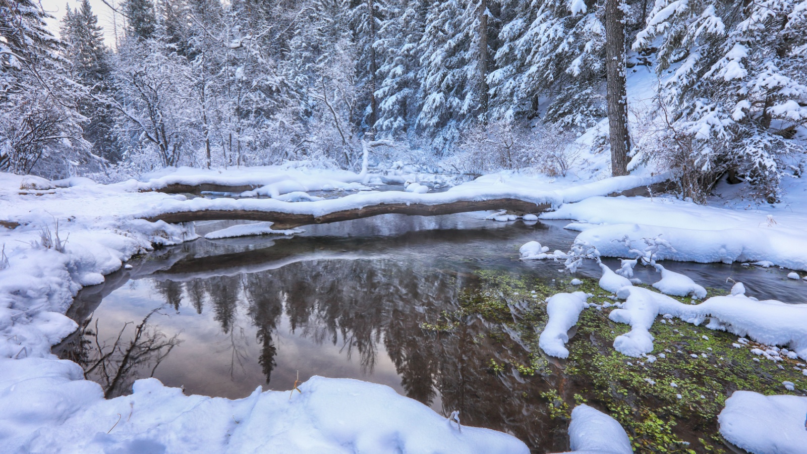
Canada’s immense landscape has unsettled travellers, explorers, militaries, and scientists for centuries. Vast empty distances, seasonal darkness, punishing cold, unstable coastlines, shifting ice sheets, and violent weather systems continue to challenge international expectations. For outsiders accustomed to controlled environments, Canada presents a reminder that nature still rules vast sections of Earth. Here are 14 times Canadian geography terrified the rest of the world.
14 Times Canadian Geography Terrified the Rest of the World
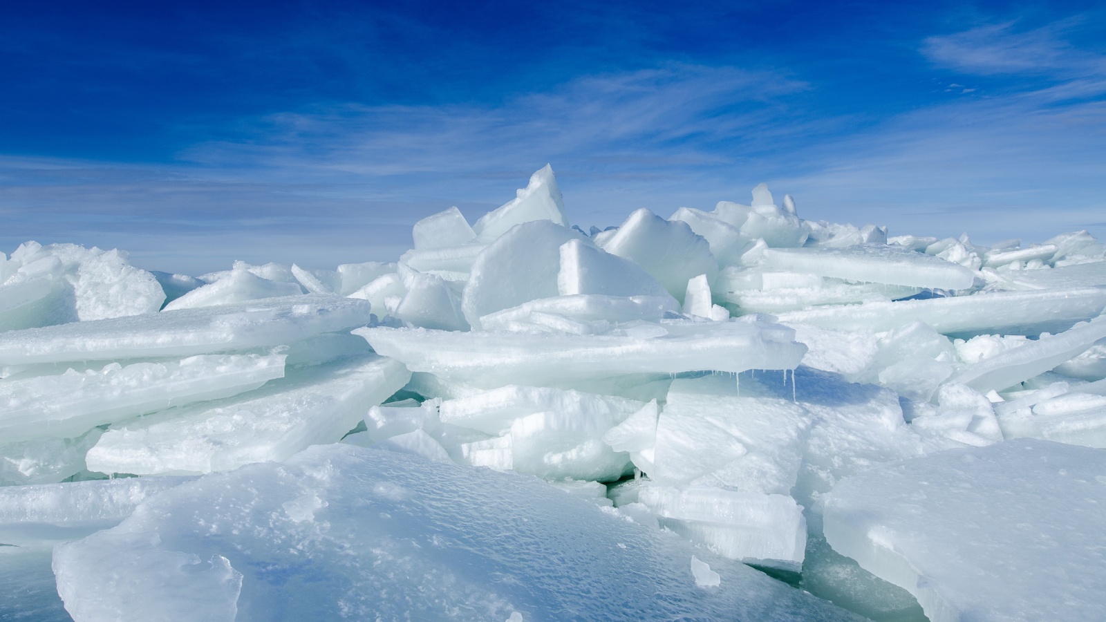
- Franklin Expedition Ice Trap – Nunavut (1845)
- The Halifax Explosion Shock Wave – Nova Scotia (1917)
- The Great Slave Lake Plane Crash Wilderness Search – Northwest Territories (1956)
- The Columbia Icefield Glacial Collapse – Alberta (1960s Research Era)
- The Pine Barrens Wildfires – Ontario (1948)
- The Grand Banks Deadly Fog Zones – Newfoundland (Aviation Warnings 1950s)
- Whitehorse Winter Airfield Isolation – Yukon (Cold War Era)
- The 1964 Good Friday Tsunami Impact – British Columbia
- The Tornado Outbreak of Southern Ontario – 1985
- Ice Road Failure Crisis – Northern Manitoba (1990s)
- The Slave Lake Wildfire Destruction – Alberta (2011)
- Polar Vortex Freeze Spillovers – National Impact (2014)
- Mount Meager Volcanic Landslide Threat – British Columbia (2010)
- Northwest Passage Opening Anxiety – Arctic (2007 onward)
- 22 Groceries to Grab Now—Before another Price Shock Hits Canada
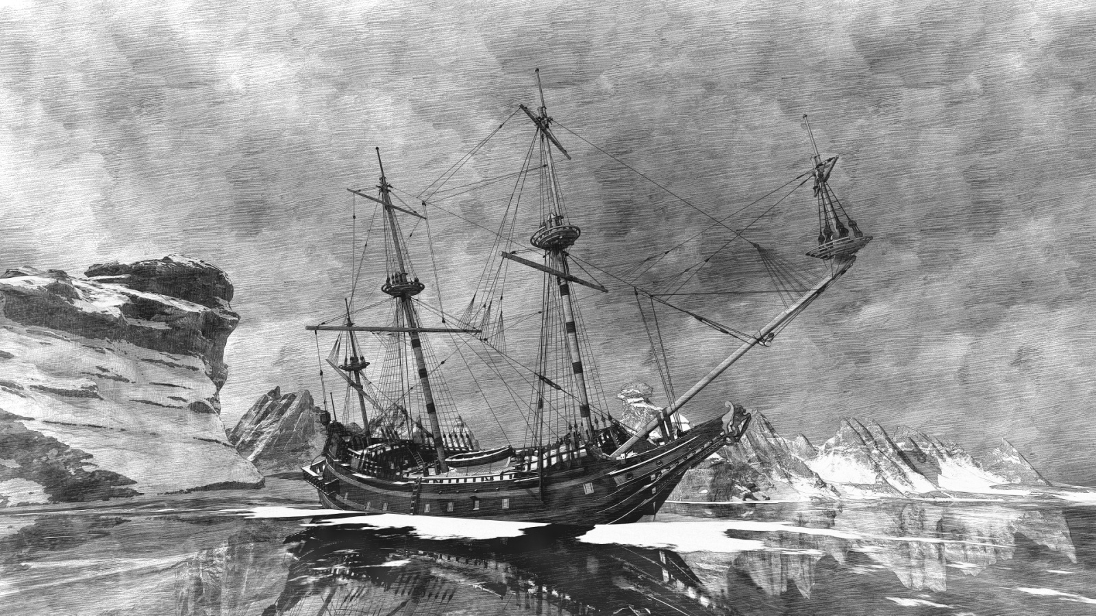
In 1845, Sir John Franklin led two British ships seeking the Northwest Passage across Arctic Canadian waters. Within months, the vessels became trapped in pack ice near King William Island. They remained frozen in place for two years. Crew members eventually abandoned their ships and attempted overland escape. None survived. Global audiences learned how permanent Canadian sea ice could overwhelm even heavily equipped naval expeditions. Subsequent search missions spanning decades uncovered bodies showing starvation signs and scurvy evidence. Reports also indicated extreme cold exposure injuries. Inuit accounts described desperate final marches across unstable ice fields. The tragedy shocked the international exploration community. It destroyed romantic visions of Arctic navigation convenience. The case permanently linked Canadian Arctic geography with lethal unpredictability. The rescue failures cemented fears of the Northwest Passage as a death corridor rather than a route to trade success.
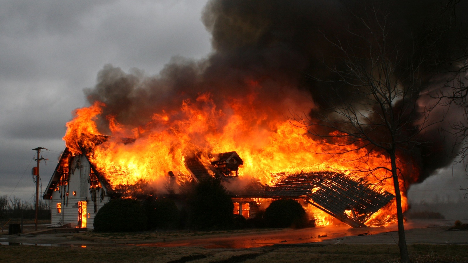
The Halifax Explosion Shock Wave – Nova Scotia (1917)
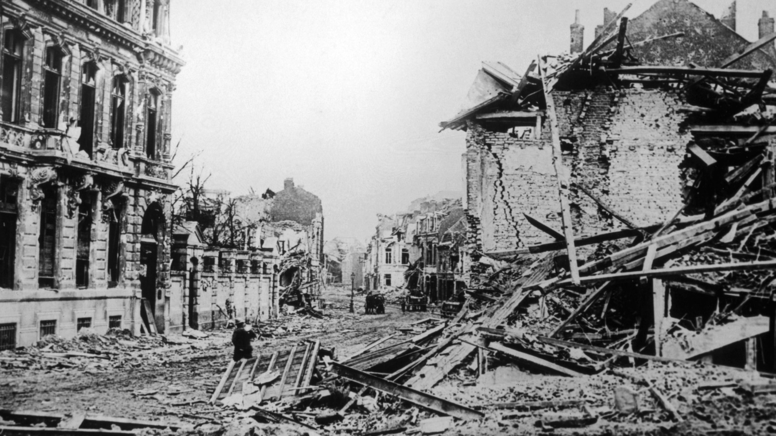
In December 1917, two ships collided in Halifax Harbour, including a munitions vessel carrying wartime explosives. The resulting blast became the largest man-made explosion before atomic testing. The force obliterated entire neighbourhoods and was felt more than two hundred kilometres away. Windows shattered across Nova Scotia and into parts of the northeastern United States. The shockwave flattened buildings, sent debris raining into the harbour, and killed approximately 2,000 people instantly. International media reacted with disbelief as photos showed entire sections of the port city erased. The disaster revealed how Canada’s natural harbour geography magnified blast impacts by funneling force inland. Maritime safety agencies worldwide studied the explosion aftermath closely. Military planners acknowledged how coastal geography could transform accidents into catastrophic events. Halifax became synonymous internationally with geographic vulnerability combined with industrial risk factors.
The Great Slave Lake Plane Crash Wilderness Search – Northwest Territories (1956)
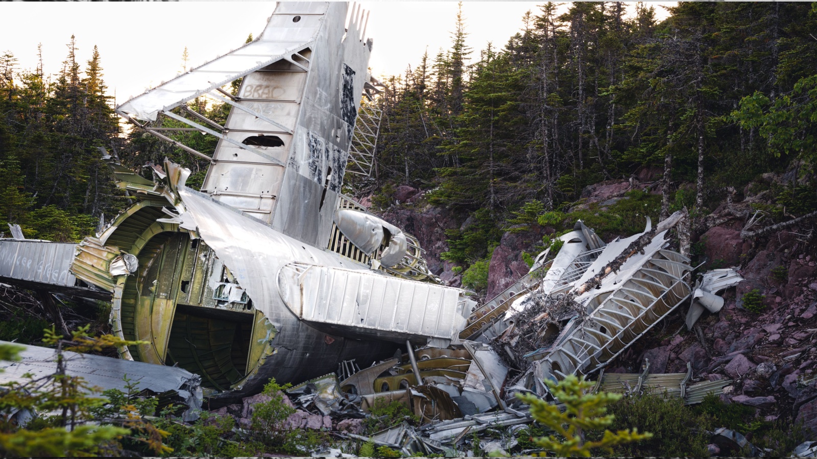
In 1956, a military transport aircraft crashed into the wilderness near Great Slave Lake in northern Canada. Rescue coordination became an international logistical nightmare. The dense forest, frozen muskeg wetlands, and absence of mapping infrastructure severely limited search operations. American and Canadian aerial teams combed thousands of square kilometres with no immediate success. Survivors remained stranded for days in subzero conditions before rescue. Global news coverage highlighted the desperate plight and Canada’s intimidating search terrain. The crash demonstrated how geographic isolation could delay emergency response even with modern aircraft technology. Survival depended on wilderness navigation skills rather than rescue efficiency. NATO emergency response planners later identified the rescue as a case study in geographic operational limitation. Public awareness grew surrounding how Canada’s vast terrain nullified rapid modern rescue assumptions entirely.
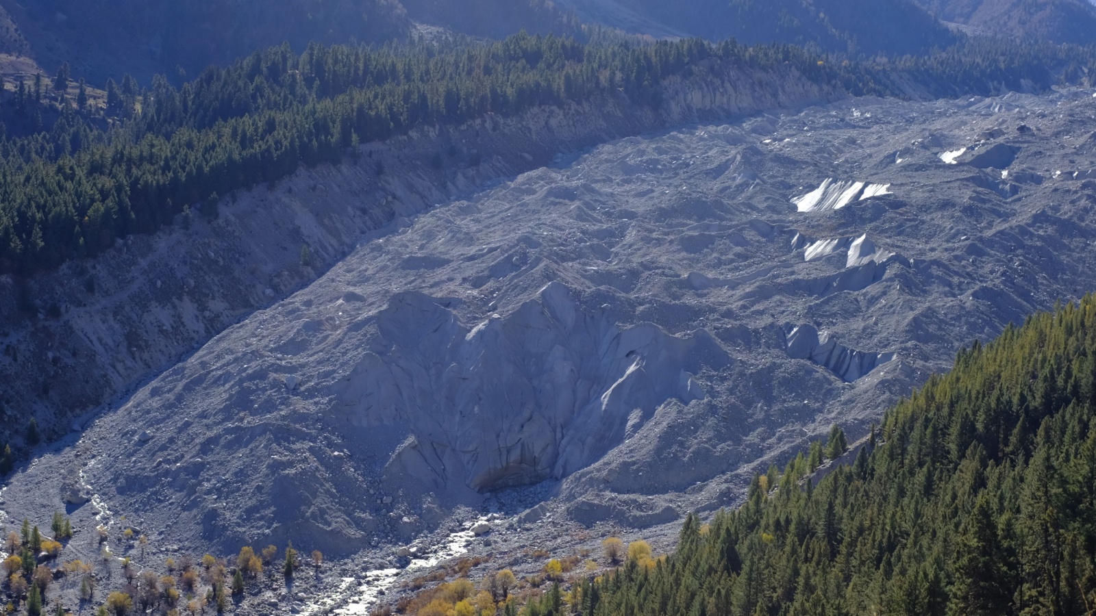
The Columbia Icefield Glacial Collapse – Alberta (1960s Research Era)
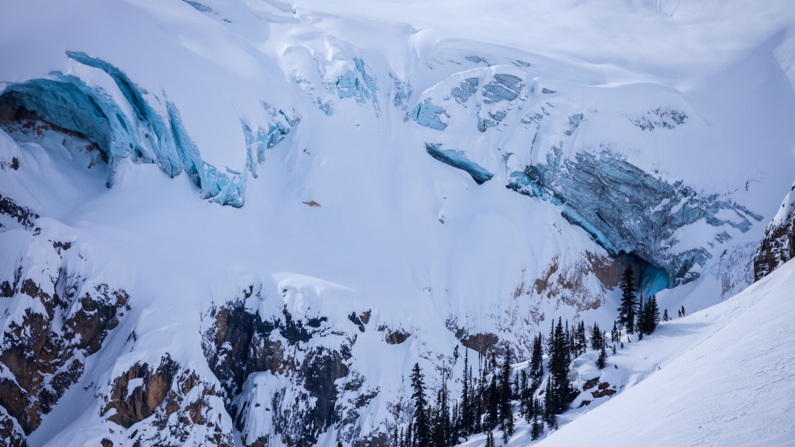
During the early 1960s, international scientists monitoring the Columbia Icefield observed unexpected multi-stage glacial fracturing events. Massive ice shelves cracked and collapsed into valleys below, releasing roar-level vibrations detected by nearby seismic instruments. Avalanche debris fields expanded across kilometres unexpectedly. Research teams evacuated work zones multiple times due to unpredictable movements. Reports circulated globally, warning of the destabilization risks present within temperate glaciers located in Canada’s Rocky Mountains. Climatologists highlighted how warming cycles uniquely impacted Canadian glacial systems that had appeared stable for millennia. The phenomenon challenged earlier glaciology assumptions. Academic journals described the Canadian Rockies as a new laboratory for climate chaos observations.
The Pine Barrens Wildfires – Ontario (1948)
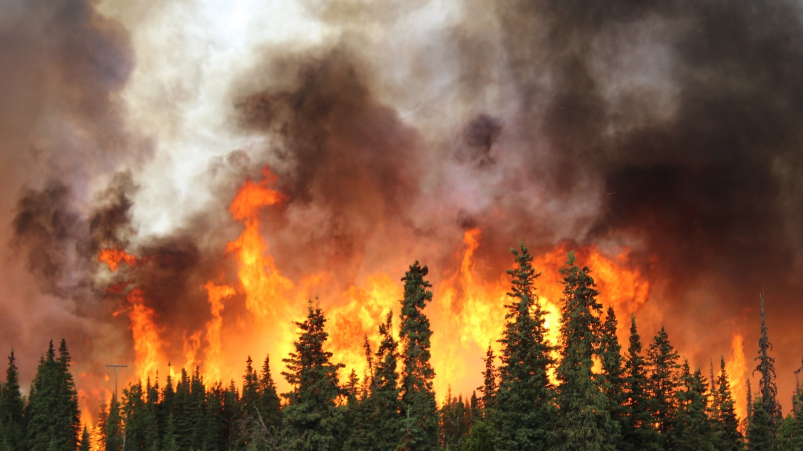
Ontario’s Pine Barrens wildfires of 1948 burned aggressively across dry boreal forest corridors faster than firefighting technology could control. Wind shifts spread flames unpredictably. Communications malfunctioned due to remote geography. Evacuation warnings reached communities with limited notice. The scale stunned international forestry agencies. Hundreds of kilometres of forest burned within days. Smoke travelled across the Great Lakes into U.S. airspace. American aviation authorities grounded flights temporarily due to visibility collapse. Post-fire studies revealed Canadian forest compositions supported uniquely intense crown fire behaviour. International fire control experts revised containment planning following the disaster. Canada’s wildfire risks entered global safety planning discussions as examples of uncontrollable geographic fire conditions capable of crossing borders physically and economically.
The Grand Banks Deadly Fog Zones – Newfoundland (Aviation Warnings 1950s)
Throughout the 1950s, Newfoundland’s Grand Banks became infamous among international aviators for its persistent, deadly fog layers. Cold Labrador currents met warmer Atlantic streams, generating near-constant dense vapor fields. Pilots reported total visibility collapse even minutes after clear-flight departures. Navigation radios malfunctioned under moisture load pressures. Multiple near-crashes and fatal aviation accidents occurred. International civil aviation authorities issued warnings advising extreme caution near Canadian Atlantic coastal routes. The fog’s unpredictability defied forecasting tools for decades. Several European airlines rerouted transatlantic approaches to avoid Grand Banks exposure. The area gained worldwide reputation as one of aviation’s most treacherous natural weather traps. Canadian geography again demonstrated its capacity to override technological measures and endanger global transit corridors.
Whitehorse Winter Airfield Isolation – Yukon (Cold War Era)
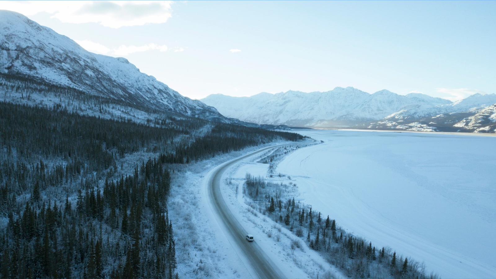
During the Cold War, Whitehorse functioned as an emergency landing strip for Arctic military flights. Extreme weather closures stranded multiple international crews periodically. Temperatures dropped below minus forty degrees Celsius regularly. Aircraft engines froze unexpectedly even with heating precautions. Runway ice conditions delayed take-offs for days. International military planners grew anxious about reliance on northern Canadian landing infrastructure. Controlled operations could not defeat geographic temperature dominance. Whitehorse exemplified how Canadian cold constrained aerospace contingency planning on a global defense scale. Reports emphasized that geography acted as an unpredictable variable uncontained by modern systems. Canada’s climate forced strategic military routing adjustments across North America.
The 1964 Good Friday Tsunami Impact – British Columbia
When Alaska’s massive Good Friday Earthquake struck in March 1964, shockwaves travelled across the Pacific toward British Columbia’s coastline. Tsunami surges slammed into coastal communities from Vancouver Island to Prince Rupert. Floating docks ripped loose and fishing vessels smashed against shore infrastructure. Although coastal elevations reduced casualties, property losses were severe. International seismic centers observed that Canadian coastal geography funnelled wave energy onto narrow harbour entrances. Researchers labelled the region highly vulnerable to trans-Pacific seismic events. The incident forced global governments to examine Pacific tsunami preparedness plans. Canadian coastal risks became integral to international disaster modelling efforts afterward. Scientists warned that seismic geography along Canada’s western continental shelf could funnel future wave amplification pathways.
The Tornado Outbreak of Southern Ontario – 1985

In May 1985, a rare tornado outbreak swept across Southern Ontario, killing twelve people. More than one hundred tornado touchdowns occurred that day. Entire neighbourhoods across Barrie, Grand Valley, and Orangeville suffered catastrophic damage. International meteorological agencies expressed shock at how Canadian geography produced multi-cell tornado clustering events similar to U.S. tornado alley outbreaks. The Great Lakes moisture convergence over Ontario created unprecedented atmospheric instability. Forestry devastation extended across entire townships. Insurance losses reached record levels for Canada. Global weather analysts reassessed thunderstorm formation maps across southern Canada following the disaster. Ontario suddenly appeared on severe storm threat models worldwide. Tornado mapping expanded northward permanently.
Ice Road Failure Crisis – Northern Manitoba (1990s)

Throughout the 1990s, several ice road collapses occurred across northern Manitoba’s winter transportation network. Heavy supply trucks crossed frozen rivers and lakes, serving Indigenous communities. Unexpected warm fronts weakened ice integrity without surface warning. Loaded vehicles plunged through the ice, causing fatalities. Rescue responses were hindered by geographic remoteness and subzero conditions. International logistics planners referenced these incidents as examples of climate risk exposure in infrastructure dependence. Supply chain vulnerability studies expanded to include northern ice corridors as unstable transit systems. Canadian winter geography demonstrated that even engineered transport systems remained hostage to environmental unpredictability.
The Slave Lake Wildfire Destruction – Alberta (2011)
In May 2011, a wildfire driven by unprecedented wind conditions engulfed Slave Lake within hours. Over 400 homes burned. Approximately 7,000 residents evacuated rapidly. Fire travelled faster than suppression crews could advance. International wildfire agencies studied the footage with alarm. Canadian boreal forest compositions fuelled explosive crown fires with unique intensity. Urban layouts near woodland increased vulnerability severely. Smoke spread internationally, darkening skies across northern U.S. regions temporarily. Climate experts cited Slave Lake as early evidence of extreme fire behaviour emergence due to warming prairie interactions. Emergency management structures were redesigned afterward to accommodate hyper-rapid evacuations. Canada’s geography showed the capacity to overwhelm response infrastructures easily.
Polar Vortex Freeze Spillovers – National Impact (2014)
The 2014 polar vortex sent arctic air plunging across much of Canada into the United States. Canadian temperature systems created pressure gradients, pushing frigid air southward violently. Airports shut down internationally. Power grids failed under ice loads. Rail transport halted across provinces. American news broadcasts focused intensely on “Canada sending the cold.” Meteorological modelling concluded Canada’s northern geographic trough channels effectively funnel extreme winter patterns into continental weather systems. Global emergency planning recognized Canada’s climate influence beyond its borders after the freeze. Energy reliability risk assessments expanded cross-border studies substantially.
Mount Meager Volcanic Landslide Threat – British Columbia (2010)
Remote monitoring detected severe slope destabilization at Mount Meager in 2010. The volcanic massif held loose debris towers compressing unstable ice meltwater. Warnings predicted possible massive landslides into inhabited valleys. Geologists compared projections to deadly international volcanic debris flows. Evacuation contingency planning extended to downstream communities. Scientists identified Mount Meager as one of the most dangerous dormant volcano systems in North America. Satellite surveillance expanded permanently following initial warnings. Public communication campaigns educated residents on Canadian volcanic hazards, which are often overlooked internationally. Concern grew globally over volcanic landslide risk within Canada’s remote geology zones.
Northwest Passage Opening Anxiety – Arctic (2007 onward)
In 2007, satellite imagery confirmed that record Arctic ice retreat opened sections of the Northwest Passage to ship navigation. International shipping interest spiked immediately. However, Canada’s geography terrified pilot agencies globally. Narrow passages, unpredictable drifting ice sheets, extreme weather cycles, and unmapped shoals made navigation extremely risky. Several early voyages became stranded, requiring icebreaker rescues. Maritime insurers increased premiums heavily for Arctic routes. Shipping safety agencies warned that the environment outpaced mapping capabilities. Canada’s Arctic exhibited uncontrollable navigation dangers despite the climate opening routes. The world realized geography alone remained a barrier to commercial ambition.
22 Groceries to Grab Now—Before another Price Shock Hits Canada

Food prices in Canada have been steadily climbing, and another spike could make your grocery bill feel like a mortgage payment. According to Statistics Canada, food inflation remains about 3.7% higher than last year, with essentials like bread, dairy, and fresh produce leading the surge. Some items are expected to rise even further due to transportation costs, droughts, and import tariffs. Here are 22 groceries to grab now before another price shock hits Canada.
22 Groceries to Grab Now—Before another Price Shock Hits Canada
This Options Discord Chat is The Real Deal
While the internet is scoured with trading chat rooms, many of which even charge upwards of thousands of dollars to join, this smaller options trading discord chatroom is the real deal and actually providing valuable trade setups, education, and community without the noise and spam of the larger more expensive rooms. With a incredibly low-cost monthly fee, Options Trading Club (click here to see their reviews) requires an application to join ensuring that every member is dedicated and serious about taking their trading to the next level. If you are looking for a change in your trading strategies, then click here to apply for a membership.